3 tracks to check out this summer
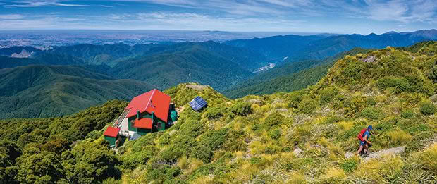
New Zealand has no shortage of inexpensive adventures.
Words & photos: Shaun Barnett
The backcountry is full of huts, some suited to dedicated outdoorsy types while others are accessible to curious wanderers. Hiker Shaun Barnett has identified the country’s best in a book called Tramping in Aotearoa. Here are three tempting options to inspire a summer adventure.
MOUNT HOLDSWORTH, TARARUA RANGES, 20 MINUTES FROM CARTERTON
Since the Mount Holdsworth Track Committee built the first Mountain House in 1907, this tramp has enjoyed increasing popularity. With two huts on the bush edge and another set in the forest of the Te Whakatūrākau Valley, the circuit has become a Tararua classic. While fit trampers can complete the entire route in one day, staying overnight at either Powell or Jumbo Hut provides a more leisurely tramp.
The tracks are suitable for the average tramper. However, the section along the tops calls for care, particularly in high winds or low visibility. Winter conditions may require the use of an ice axe and crampons. In soft snow conditions, traversing the tops using snowshoes can be a good option. The circuit can be walked either way and is described here in a clockwise direction.
Mt Holdsworth Road to Powell Hut (32 bunks, gas cookers, wood burner), 3.5–4 hours, 7km
From the car park, follow a track up the valley, making sure you stop at Holdsworth Lodge to sign the intentions book. Shortly beyond the lodge, the track crosses the Te Whakatūrākau River by footbridge. After 10 to 15 minutes’ walk, the track forks; head left up the well-benched Gentle Annie Track, which climbs steadily through diverse forest. A platform at Rocky Lookout provides a chance for a rest. Beyond, more climbing ensues, passing the track that branches off to Tōtara Flats Hut. Near Pig Flat, the Mountain House offers shelter and water. Beyond Mountain House, the track steepens for the final push up to Powell Hut. Powell is the most popular hut in Tararua Forest Park and affords excellent views over the Wairarapa Plains.
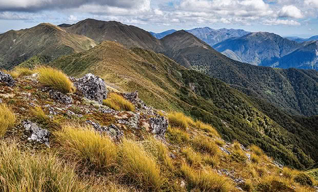
Mt Holdsworth and the Main Range from Pukeahurangi / Jumbo.
Powell Hut to Jumbo Hut (20 bunks, gas cookers, wood burner), 2.5–3.5 hours, 6.5km
Above Powell Hut, a route leads up to Mt Holdsworth (1470 metres), marked by a trig station. To reach Pukeahurangi/Jumbo, drop down onto the ridge leading north in the signposted direction. A trail leads across tussock tops, dropping to a low saddle and then beginning a climb up past a tarn towards Pukeahurangi (1405 metres). Near the summit, a signpost indicates the spur leading to Jumbo Hut on a steep descent marked by poles.
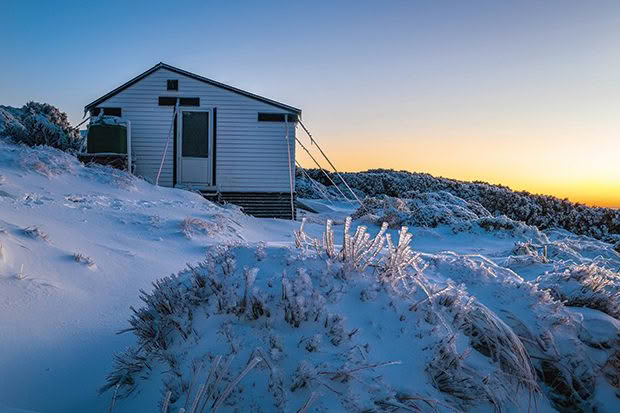
Jumbo Hut at sunrise in winter.
Jumbo Hut to Atiwhakatu Hut (26 bunks, wood burner), 1.5 hours, 2.5km
From Jumbo Hut, follow a steep track down Raingauge Spur through beech forest. Gradually, the vegetation becomes more diverse before, finally, the gradient eases when the track reaches Te Whakatūrākau Valley. Atiwhakatu Hut lies a short distance downstream.
Atiwhakatu Hut to Holdsworth Lodge, 2–3 hours, 7km
The track down Te Whakatūrākau is well-benched and bridged, providing all-weather access. It’s fast travel to East Holdsworth Creek. Beyond, the track to Donnelly Flat passes some good viewpoints of the river’s gorges. Donnelly Flat, with good spots for camping, is 20 minutes from Holdsworth Lodge.
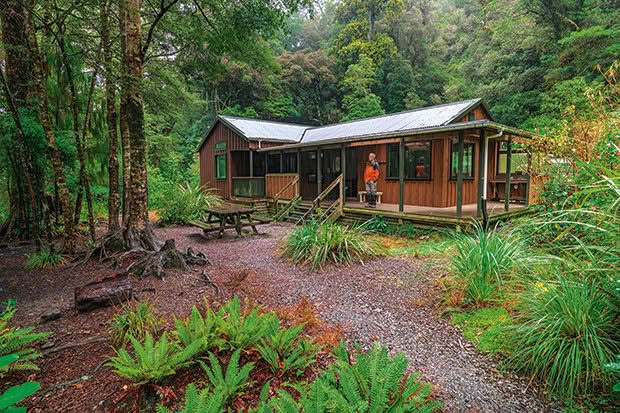
Atiwhakatu Hut.
Holdsworth; Jumbo Circuit
Grade: Medium
Map: Topo50 BP34 Masterton
Access: Turn off State Highway 2 onto Norfolk Road, 2km south of Masterton. Follow Norfolk Road for 15km to reach the end of Mt Holdsworth Road, where there is a large car park, camping area and toilets.
Huts Powell Hut costs $25/night, or $12.50 for youths aged 5–17 (or $30 for adults and $15 for youths for Saturday night stays). Jumbo Hut costs $25/night, or $12.50 for youths aged 5–17. Atiwhakatu Hut costs $10/night, or $5 for youths aged 5–17 (or $15 for adults and $7.50 for youths for Saturday night stays). All huts are covered by a Backcountry Hut Pass and must be booked well in advance (bookings.doc.govt.nz). Holdsworth Lodge is available for overnight stays. Book in advance.
Information: DOC Kapiti Wellington Visitor Centre, (04) 384 7770, email: wellingtonvc@doc.govt.nz.
AOTEA/GREAT BARRIER ISLAND
Aotea/Great Barrier Island is New Zealand’s sixth-largest island. Aotea’s rugged volcanic topography, fine regenerating kauri forest, outstanding views over the Hauraki Gulf/Tīkapa Moana and a climb of Mt Hobson/Hirakimata make for a tramper’s paradise. The birdlife is excellent, too, with flocks of kākā, kākāriki and the pītoitoi.
Windy Canyon to Mt Heale Hut (20 bunks, wood burner) via Palmers Track and Mt Hobson, 3–3.5 hours, 4km
Palmers Track begins from Aotea Road, 16 kilometres from Claris. The track passes through forest, then enters the narrow defile known as Windy Canyon. The gradient eases on a ridge crest.
A climb ensues towards the summit of Hirakimata. Shortly before the summit is a signposted junction with the Kaiaraara Track. A side track leads up to the summit (621 metres), where the viewing platform leads to panoramic views. The summit is also a habitat for several rare plants, including the great barrier tree daisy. Back at the junction, the track descends more stairs. Mt Heale Hut is on the mountain’s southern side.

Te Hauturu-o-Toi / Little Barrier Island from Mt Hobson / Hirakimata.
Day trip around the Kaiaraara Track via Kaiaraara Hut and South Fork Track, 5–7 hours, 11km
Pack a daypack and enjoy a circuit around the Kaiaraara Stream catchment. Follow the Peach Tree Track before reaching a signposted junction and taking the South Fork Track. Beyond, the track descends steadily, sidling across steep bush faces. Eventually, it reaches the south fork in the Kaiaraara Stream. After fording, the track continues downstream. A second ford across Kaiaraara Stream leads to a short ascent to Forest Road. Follow the road to reach Kaiaraara Hut (28 bunks, wood burner).
Beyond the hut, head upstream on the Kaiaraara Track. The track climbs gradually, crossing the stream several times. Past a junction with Coopers Castle Track, the track begins to steepen. Higher up are views of volcanic rhyolite outcrops, beyond which an extensive series of wooden stairs ascend the steeper slopes leading back towards the summit of Hirakimata.
Mt Heale Hut to Whangaparapara Road via Peach Tree, Tramline and Kaitoke Hot Springs tracks, 3–4 hours, 8.5km (walk to Claris airfield an additional 60–75 minutes, 4.5km)
Take the Peach Tree Track, which descends into the Kaitoke Valley to intercept the Tramline Track. Follow this for 30 minutes until reaching the Kaitoke Hot Springs Track, which climbs over a low brow to reach the natural hot springs located on the extensive Kaitoke Creek wetland. The last section of track is a 40-minute stroll to Whangaparapara Road.
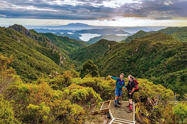
Trampers on the Kaiaraara Track.
Aotea Track
Grade: Medium
Map: Topo50 AY34 Claris
Access: A regular Sealink ferry operates from Auckland to Tryphena (4.5 hours). Alternatively, two airlines operate daily flights to the small airfield at Claris (30 minutes). Shuttle operators have services to transport you to the track’s start at Windy Canyon.
Huts: Mt Heale and Kaiaraara huts cost $25/night, or $12.50 for youths aged 5–17. Both huts are covered by a Backcountry Hut Pass but must be booked in advance (bookings.doc.govt.nz).
Information: Tāmaki Makaurau / Auckland Visitor Centre, (09) 379 6476, email: aucklandvc@doc.govt.nz.
For information on Great Barrier transport and accommodation, visit greatbarrier.co.nz.
LAKE DANIELL, LEWIS PASS SCENIC RESERVE, WEST COAST
A gentle, graded track, stately beech forests, good fishing and a tranquil lake combine to make Lake Daniell a superb overnight destination. Located near the shore is the large, modern, Kōhanga Atawhai/ Manson Nicholls Hut.
Set among forested peaks, Lake Daniell was formed thousands of years ago by a landslide. Another landslide in 1974 destroyed a fishing hut on the lake’s western shores, tragically killing the three trampers sheltering inside.
To remember them, friends from the Christchurch Tramping Club and Lake Daniell Fishing Club built a second hut, this time on the lake’s southeastern shore.
Opened in 1976, the Manson Nicholls Memorial Hut became increasingly popular. After decades of service, however, the ageing hut needed replacement. DOC opened Kōhanga Atawhai/Manson Nicholls Hut in March 2020 and introduced a booking system.
Near the hut, a small jetty protrudes into the lake, making it the perfect place to appreciate the area’s tranquility. Those with permits can try their luck catching rainbow trout from October to April.
With persistence, it’s possible to follow overgrown tracks to the lake’s northern side for a different view.
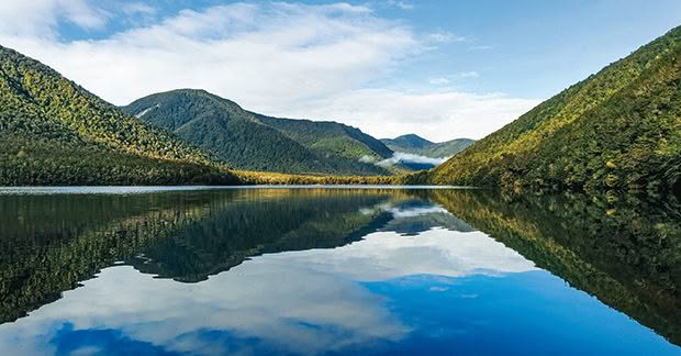
Reflections on the northern end of Lake Daniell.
Marble Hill Picnic Area to Kōhanga Atawhai/Manson Nicholls Hut (20 bunks, wood burner) 2–3 hours, 8.4km
The tramp begins from the car park at the Marble Hill Picnic Area. Follow the gravelled track for 10 minutes to the Sluice Box, a narrow marble canyon through which the Maruia River passes.
Cross the footbridge, then follow the track along the true right bank of the Alfred River, passing through red beech forest at a gentle gradient.
Opposite, where the Pell Stream tributary joins the Alfred River, a bench seat offers trampers a place to rest. Further up, the track branches up Frazer Stream and, after a kilometre or so, begins to climb gently over a forested lip to reach Lake Daniell. The hut lies a few minutes’ walk away.
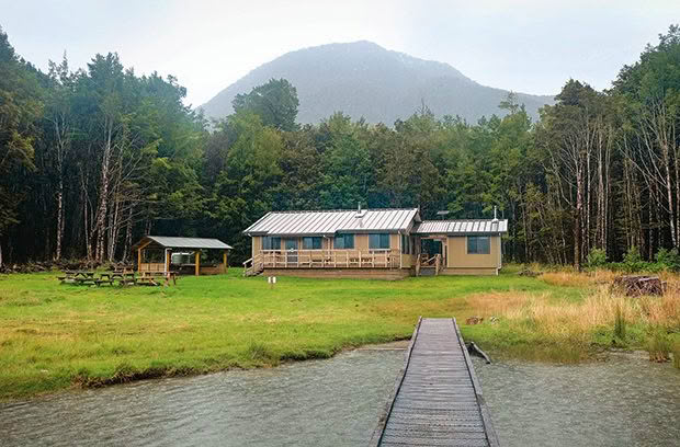
Kōhanga Atawhai/Manson Nicholls Hut.
Lake Daniell Track
Grade: Easy
Maps: Topo50 BT22 Springs Junction, BT23 Lewis Pass
Access: The Marble Hill Picnic Area (picnic tables, information panels, toilet and camping area) lies 5km east of Springs Junction, just off State Highway 7. Kōhanga Atawhai/ Manson Nicholls Hut costs $15/night, or $7.50/night for youths aged 5–17, and is covered by a Backcountry Hut Pass but must be booked well in advance (bookings.doc.govt.nz). Camping costs $5/night, or $2.50/night for youths.
Information: Reefton Visitor Information Centre, (03) 732 8391, email: rvcinfo@xtra.co.nz.
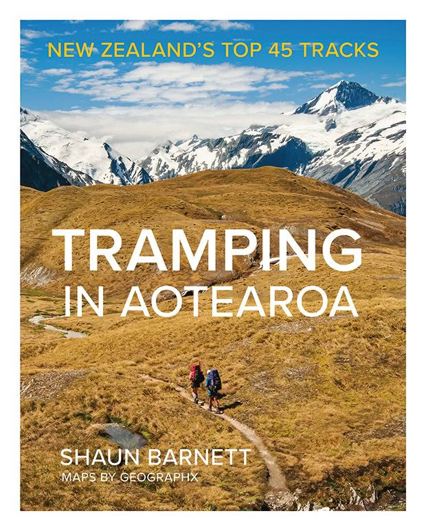
Extracted from Tramping in Aotearoa: New Zealand’s Top 45 Tracks by Shaun Barnett. Published by Potton & Burton.
Love this story? Subscribe now!
 This article first appeared in NZ Life & Leisure Magazine.
