The view from the top of the Seaward Kaikōura Range is worth the climb
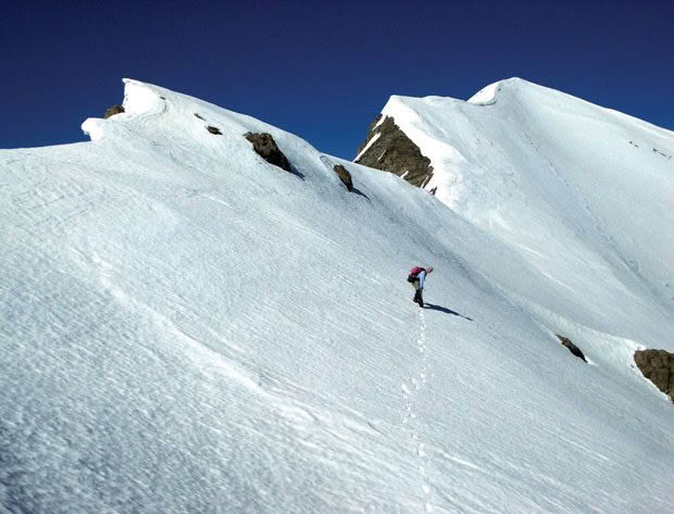
Climbing the final snow slope to the summit of Manakau with crampons and ice axe.
The remote beauty of the Seaward Kaikōura Range allows for the avid climber to trek through historical footsteps.
Words and photos: Extracted from Alpine Panorama: A view to climb by Andy Buchanan
The panorama has nine peaks in the Seaward Kaikōura Range, extending from Cloudy Range in the south to Te Ao Whekere in the north, including Mt Horrible, Mt Clear, Snowflake and Mt Saunders. The most dominant peak, Manakau, is only 12km from the coast. This group also includes Warder, which is a few kilometres to the west in the Clarence Valley.
The snow-capped peaks of the Seaward Kaikōura mountains have been admired for centuries. They dominate the Kaikōura coastline and are a striking feature when viewed from the Port Hills 160km away to the south. Captain James Cook’s journal entry of Wednesday, 14 February 1770, mentions the sight of both the Inland and Seaward Kaikōura ranges from sea. They feature in early Māori history and have been explored by many parties via multiple routes since then.
The history of farming in the Seaward Kaikōura area is a story of many interlocking pastoral runs going through cycles of boom and bust, merger and acquisition, as described in the history of the district by J.M. Sherrard. One of the earliest runholders on the north side of the range was Joseph Ward. His name gave rise to the Warden sheep run and the Warder (1481m), which is visible on the panorama.
Ward arrived in New Zealand in 1842 and applied for the run in the Clarence Valley in 1857. He explored the rivers and passes north over the Inland Kaikouras, including Tone Saddle, and south over the Seaward Kaikouras, including Palmer Saddle and Blind Saddle, often burning the scrub as he went. Fires were often used to clear the land of impenetrable matagouri and Spaniard to make foot travel and sheep droving possible, repeated later to encourage new grass growth.
There were many early difficulties farming sheep on the remote Puhi Puhi run, including prosecutions for scab infestation in the 1880s, leading to thousands of infected sheep being slaughtered. The run was then left unstocked for two years, when gangs of wild-sheep hunters were paid by the Sheep Department to kill, burn or bury thousands more remaining sheep. When we climbed Te Ao Whekere in 2018, it appeared that there were no sheep left at Puhi Peaks Station, but conspicuous numbers of wild deer were available for hunting.
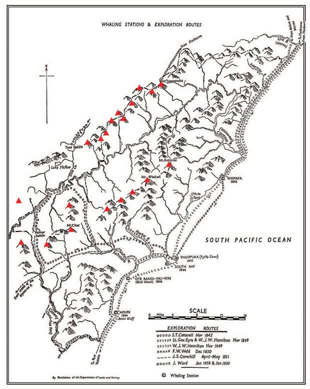
Early European exploration routes are shown on the historical map above. The added red triangles indicate the location of the panorama peaks. The endangered Hutton’s shearwater or titi have their only remaining breeding grounds in two remote valleys in the Seaward Kaikōura mountains. One of these is in the headwaters of the Kowhai River and the other in Shearwater Stream up the Puhi Puhi River below Tarahaka (2283m). Early Māori history refers to Kaitarau as the mountain above Kaikōura where Māori from Omihi went each year to hunt for tītī or mutton-birds.3 The rediscovery of these breeding areas by mountaineer Geoff Harrow in the 1960s and continuing research into Hutton’s shearwater are described in a fascinating book by Richard Cuthbert.4 A third breeding ground has since been established inside a predator-proof fence on the Kaikōura Peninsula.
The Seaward Kaikouras have a reputation for being remote and inhospitable; hot and dry in summer with deep snow in winter. There have been some deaths over the years, including of two lightly-clad teenage musterers who died on Snowflake in December 1904 in a summer snowstorm. In 1964 Derek Winter was blown off Mt Uwerau and Peter Maxwell fell from Surveyor Spur in 1991.5 Geoff Spearpoint describes ‘the cold, the deep, bone-chilling cold’ of an unplanned night out on Manakau in May 1971. The first recorded ascent of Manakau was by James Ingram in 1874.
Mt Saunders and Snowflake are most easily climbed from the Kowhai River behind Mt Fyfe, but since the 1930s some of these peaks have been climbed from Dubious Stream in the Clarence Valley.
I found the three peaks of Cloudy Range, Mt Horrible and Mt Clear accessible by vehicle on 4WD farm tracks from the Inland Kaikōura Road, with the permission of landowners. Volker Nock and I drove up the steep Cloudy Range Station road to the saddle over into the Clarence Valley, from where we made an easy climb to the summit. For both Mt Horrible and Mt Clear another friend and I drove up as high as possible and camped out in preparation for a climb the next day. When driving up Hawk Ridge towards Mt Clear we were surprised to pass through a large native forest of young tōtara trees – unlike the vegetation seen on any adjacent mountains, except for slightly smaller areas seen later on Snowflake and Mt Saunders.
The middle peaks of the Seaward Kaikouras are among the most remote in the entire panorama. Mt Saunders, Snowflake and Peak 5750ft are rugged and inaccessible. They are challenging to climb because they are so high and rugged, yet so close to the sea. The closest road is at Blind Saddle, which is the high point on the road over the Seaward Kaikouras to Muzzle Station in the Clarence Valley.
My first attempt to climb these three peaks was an over-ambitious Easter tramp with three friends to Dubious Biv in the Clarence Valley after a long 4WD drive to the top of Limestone Hill. After a night at the biv we abandoned the attempt because of uncertain weather, which was just as well, because the lack of water, the rugged terrain and no easy escape route could have led to trouble. We then drove north towards Dillon Cone and took a side-trip to climb Warder (1481m), an easy climb from the north over sheep-grazed tussocks from the road between Seymour Stream and Palmer Hut. Near the north foot of Warder we visited the historic Old Willows Hut on Gore Stream, a rabbiter’s hut built in the 1920s and one of the few remaining wood slab huts in Marlborough.
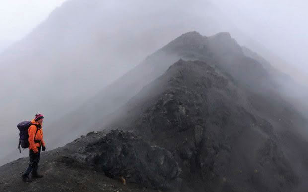
On the ridge of Cairn after climbing from Blind Saddle.
Two years later I climbed Peak 5750ft (1757m) with Stephen John after investigating several alternative routes. We finally made an out-and-back trip from Blind Saddle over Cairn (not visible on the panorama), hoping to get to Snowflake. We arrived at the peak late in the afternoon to clearing weather after an eight-hour slog in the rain.
This is the only panorama peak on which I have camped right on the summit. That night we had the Milky Way overhead, the lights of Kaikōura to the east and Christchurch far to the south. It was spectacular. The early morning views were stupendous in every direction, making the rugged trip very rewarding. Because there was no water to be found anywhere near the tops, we had to return prematurely from Peak 5750ft to Blind Saddle, so we did not get to Snowflake.
I climbed Snowflake (1870m) finally, on my third attempt, with Pat Bodger via Homestead Spur after a late September snowfall. Once again, I was over-ambitious in my planning, so a round-trip to Mt Saunders was not possible, but we achieved our primary objective. From the map, the best route was up a farm track to Homestead Spur, but as the local farmer was totally uncooperative, we took the alternative of a bush-bash up from the Kowhai River as suggested by Dunnett. Once on the spur it was generally easy walking. We chose to camp near the snow to avoid carrying water; it is a lot lighter to carry gas for a stove than several litres of water.
The next day we climbed to the top of Snowflake, finding fantastic views of peaks climbed and yet to be climbed visible in every direction.
Mt Saunders (2146m) proved to be the most difficult peak in this range. Steve and I finally climbed it on our fourth attempt after having cut a track through thick bush a few weeks earlier. We drove to the end of the 4WD track and walked to Kowhai Hut, then carried packs and drinking water to a campsite at Point 1069m to reduce our climb the next day.
On the day-climb to the summit we had to sidle a razorback ridge about halfway up. From there we could see the research hut used for the study of Hutton’s shearwaters far away in the head of the Kowhai River. Steep scree slopes near the top of Mt Saunders opened out to gentle gravel basins with the last remnants of winter snow. From the top we had views in every direction: east to Kaikōura, north to Manakau and Uwerau, and west over the Clarence River to the Inland Kaikouras.
The long descent started with lovely, long, shingle slides, but travel became slower past our campsite when we strayed from our track. This required a nasty bush-bash to the hut at the end of a long, tiring, but successful day. We drove back to Christchurch after a visit to Kaikōura for fish ’n’ chips and repairs to a dented muffler.
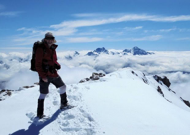
The highest point in the Seaward Kaikouras is Manakau at 2608 metres above sea level. I climbed Manakau with Dave Laurie in November 2008, taking the most-climbed route from the Hapuku River to Stace Saddle followed by the steep climb up Surveyor Spur. We reached the snowline at about 2000m before camping. The next morning we needed our ice axes and crampons for the climb over firm snow to the summit.
The views in every direction were magnificent. After descending to the car at the end of a long day we were forced to camp another night, because the vehicle ford across the Hapuku River was impassable due to the flood from melting snow.
It was not until ten years later that I climbed Te Ao Whekere (2590m) with another group of friends.
This is only 18 metres lower than Manakau, but it is a slightly easier climb because the start is at a higher elevation. We were well looked after at Puhi Peaks Station where the local farmer provided the use of a log cabin and the old shearing shed. He also lent me a pair of crampons to replace mine left at home by mistake. The next morning he drove us up the rough 4WD road to the luxury Shearwater Lodge, still damaged after the 2016 Kaikōura earthquake, saving us an hour’s climb.
From the lodge we climbed the direct route up a steep, earthquake-shattered ridge, coming out of the cloud into a steep snow basin, which we cramponed directly up to the summit. After admiring the incredible 360 degree views in every direction, we descended through the south snow basins into the Happy Valley Stream to make a round trip back to the lodge before walking back to the car.
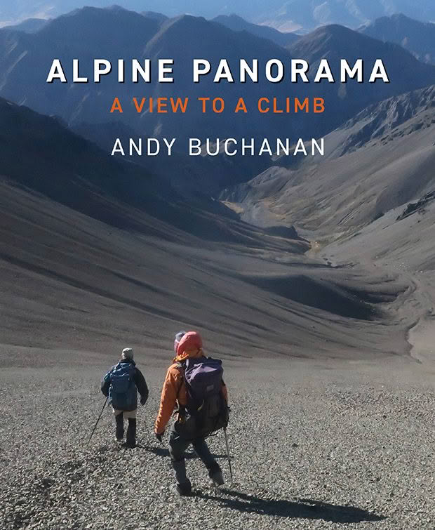
Extracted from Alpine Panorama: A view to climb by Andy Buchanan, Foreword by Peter Gough. Published by Quentin Wilson Publishing, 27 March 2024, RRP $59.9

